 (Click photo to download a PDF of the brochure)
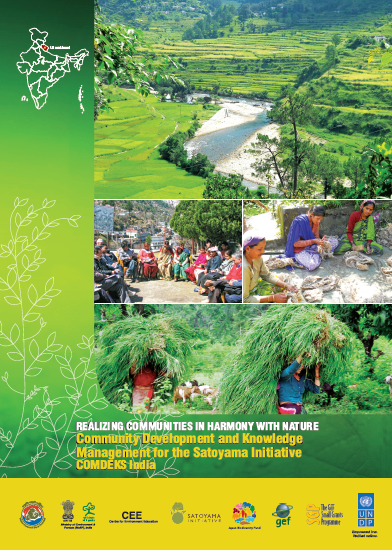
COMDEKS India with the Centre for Environment Education (CEE) has produced a brochure presenting the vision and goals of the COMDEKS Project in within Uttarakhand State, the target landscape in India. The brochure outlines the focus and expected outcomes for community based projects within the landscape including access to ecosystem services, increased agricultural productivity, and improved livelihood options.
Also featured in the brochure are maps prepared by NGO partners during program planning. The maps were created by community members using participatory methodologies. They depict the natural landscape of the region and define local resources, who has access to these resources, and who benefits from these resources.
As part of the process of empowering and consulting with the community, the COMDEKS project in India has engaged community members to participate in a consultation and village mapping exercise of the socio-ecological production landscape. The COMDEKS project in India targets a landscape within the Uttarakhand region, an area in which the interdependence between humans and nature is particularly pronounced.
Currently, the region faces increasing pressure from land fragmentation, weather changes, and desertification affecting both the natural environment and the communities that depend on it for survival. The Village Mapping exercise, combined with the use of the Resilience Indicators, creates an avenue to address these issues through knowledge sharing and relationship building on a community level. Through the mapping activities, participants are able to share valuable information on relevant features of the area, highlighting assets, problems, threats, and opportunities. Harnessing this information directly from the community in question signals to both community members and stakeholders that the community affected has expansive knowledge of local resources and issues, and is ultimately the agent behind COMDEKS activities in the region. It provides an opportunity for involvement of a greater number of both men and women from the community including those traditionally marginalized, building trust and strengthening relationships between facilitators and community members, and establishing a structure in which decision making and responsibilities are shared. This mapping activity initiates a community involvement forum which continues to be developed through regular village meetings. Finally, the maps created serve as reference material for future planning, providing important insight into the specific socio-ecological characteristics of the area.
The community consultation and village mapping exercise, together with the Resilience Indicators piloting exercise, successfully engaged stakeholders to determine the resilience of the landscape and inform the design of the COMDEKS Country Programme Landscape Strategy in India.
To read more about the COMDEKS target landscape in India, please click here.
Click on any photo in the gallery below to see maps and photos from the brochure in more detail.


