Contributed by William Dunbar, UNU-IAS
The Indicators of Resilience in Socio-ecological Production Landscapes and Seascapes (SEPLS) is an ongoing collaborative activity of the International Partnership for the Satoyama Initiative (IPSI). The first phase of the collaborative activity, carried out by the United Nations University Institute for the Advanced Study of Sustainability (UNU-IAS) and Bioversity International, was the production of a set of twenty indicators for community-based assessment of perceived resilience in SEPLS. In the second phase, UNU-IAS and Bioversity International were joined by UNDP COMDEKS and the Institute for Global Environmental Strategies (IGES) to create a toolkit for use of the indicators in the field.
COMDEKS has been piloting the implementation of the indicators of resilience in 20 countries around the world over the past three years. These indicators have been shown to be an excellent tool for creating sustainable development strategies and identifying community-based projects in various landscapes and seascapes globally.
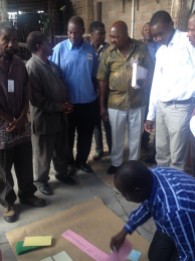
On 28 and 29 March, 2014, a workshop was held in the Ipumbu-ya-Shilongo Conservancy in northern Namibia in which the SEPLS indicators were used to conduct a baseline assessment of the current situation of the conservancy as a critical step towards the development of a landscape strategy for the area. COMDEKS Project Manager Diana Salvemini and UNU-IAS representative William Dunbar joined SGP Namibia National Coordinator Nickey Gaseb at the workshop to observe and advise during the workshops.
The Ipumbu-ya-Shilongo Conservancy was created in 2012 as a means to empower local stakeholders to manage and benefit from their resources jointly on a local level. Through the creation of a system of conservancies, Namibian land policy allows communities to address habitat conservation and resource protection by entering into collaborative land management agreements with the state. The Ipumbu-ya-Shilongo Conservancy shares its southern border with Etosha National Park, a world renowned wildlife sanctuary which is home to elephants and other African wildlife. Currently, the Conservancy is in the process of developing a long-term plan to convert part of its land for sustainable wildlife use while maintaining the viability of its agriculture, which is the primary means of subsistence for the local community. With these factors in mind, a wide range of local stakeholders, including farmers, natural resource monitors, government representatives, and community leaders were invited to participate in the assessment with an eye towards balanced representation in conducting the workshops and ultimately developing a strategy.
The assessment workshop began with an introduction by facilitators from the Desert Research Foundation of Namibia, the NGO leading the workshop. The purposes and process of the assessment were explained in depth. Next, the men and women were divided into two groups for a participatory mapping exercise in which each group drew a map of the Conservancy and its resources. With this as background, each participant then wrote down scores based on his or her perceptions for each of the twenty indicators. The scores were collected and entered into a spreadsheet for analysis after the first day’s session.
The second day of the workshop consisted of a lively discussion of the previous day’s results. While the Conservancy was generally given relatively high marks in some areas such as agricultural biodiversity, it was perceived to be lacking in ecosystem protection, with people tending to agree on the need for more enforcement and compliance with regulations. Areas for improvement were found in nearly all measured categories. The workshop wrapped up with the agreement to hold further meetings in two weeks’ time to begin development of the landscape strategy.
Beyond the immediate development of the landscape strategy and identification of projects to be carried out directly through COMDEKS, the indicators will be used as an adaptive management tool, with a plan to hold another assessment workshop within the next few years in order to identify trends in perceived resilience and to evaluate the effectiveness of the strategy. Hopefully, the Indicators of Resilience will prove to be a useful tool for assessment of current conditions and for measuring improvement in the ecological and socioeconomic landscape of the Ipumbu-ya-Shilongo Conservancy in Namibia.
To read more about the COMDEKS target landscape in Namibia, please click here


