GIS zoning

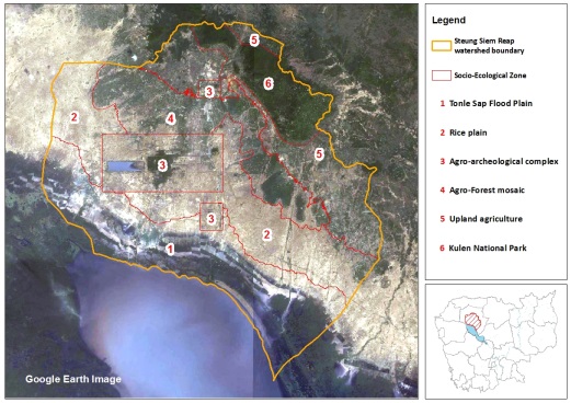
Six distinct areas were identified in the target landscape using Geographic Information System (GIS). The six zones identified include (1) Tonle Sap flood plain, (2) rice plain, (3) agro-archeological complex, (4) agro-forest mosaic, (5) upland agriculture and (6) Phnom Kulen National Park.

Leave a Reply

Fill in your details below or click an icon to log in:

WordPress.com Logo

You are commenting using your WordPress.com account. Log Out /  Change )

Twitter picture

You are commenting using your Twitter account. Log Out /  Change )

Facebook photo

You are commenting using your Facebook account. Log Out /  Change )

Connecting to %s